
Finding your way around the Bordeaux transport network is not straightforward. Between the tram lines, urban buses, Batcub river shuttles, and the very recent Bus Express, the network covers the 28 municipalities of Bordeaux Métropole. You still need to know how to read the right map at the right time, especially when extended construction work redistributes the usual routes.
Stone Bridge Works: What Changes on the TBM Network
Do you regularly use tram lines A or E to cross the Garonne? The restoration works on the stone bridge, set to last for 52 months, are profoundly altering traffic in the city center. Lines A and E are experiencing repeated summer disruptions, and lines C, D, and F are occasionally affected.
Relay buses are passing over the Saint-Jean bridge to compensate. These detours will remain in place at least until summer 2027. Before each trip to the right bank, check the traffic status on the TBM app or the dynamic map on the site infotbm.com.
The reflex to adopt: do not rely on the static network map during this period. A journey that used to take twenty minutes by tram may now take twice as long with a relay bus. By consulting the updated public transport map of Bordeaux, you can quickly identify the disrupted lines and available alternatives.

Bus Express in Bordeaux: The Fast Network Complementing the Tram
The Bordeaux tram operates in a star pattern from the city center. To travel from one peripheral municipality to another without going back through the quays, it often required two transfers. The Bus Express network changes this logic.
Line G connects the Saint-Jean station to Saint-Aubin-de-Médoc since June 2024. Lines H1 and H2, which began service in 2025, run along the Bordeaux boulevards and allow for circular travel around the center. These lines use reserved lanes, ensuring a regularity close to that of the tram.
Several other lines are under construction, with service expected to begin between 2027 and 2028:
- An outer ring line to connect the business areas located beyond the highway belt
- An inner ring line linking transfer hubs without passing through the city center
- A Presqu’île-Campus axis designed for the daily commutes of students and employees in the southern sector
- A connection from Artigues to Saint-Jean station for the right bank
On the network map, these lines will gradually appear. Identify them by their letter (G, H1, H2) to distinguish them from the standard numbered bus lines.
Reading the TBM Map: Tram, Bus, and Batcub Without Confusion
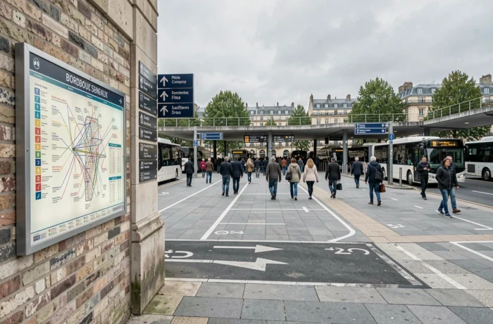
The schematic map of TBM displays the six tram lines (A, B, C, D, E, F) in distinct colors. Each color corresponds to a specific geographical axis. Tram A crosses the metropolis from east to west, while B connects the north to the south via the quays.
The bus lines, which are much more numerous, are grouped by geographical sector. The map by municipality offered on infotbm.com makes it easier to read: you select your municipality from the 28 in the metropolis, and you only see the lines that serve it. This filter helps avoid getting lost in an overloaded global map.
Three Tips to Save Time on the Map
First, identify your nearest transfer hub. The stations where tram, bus, and Bus Express intersect (such as Gare Saint-Jean or Quinconces) serve as central nodes. An optimized journey almost always passes through one of these hubs.
Next, check the real-time passage times. The dynamic TBM map displays the next arrivals at each stop. On mobile, the “Around Me” feature geolocates the nearest stations and indicates wait times.
Finally, check for construction alerts. During the stone bridge works and the rollout of the Bus Express, entire sections change routes from week to week. The static PDF map does not reflect these temporary changes.
Bicycle and Public Transport in Bordeaux: Combining Both on the Same Journey
Bordeaux Métropole has a fleet of self-service bikes (V3) and a dense network of bike paths. Combining bike and tram significantly reduces travel time over medium distances, between three and eight kilometers.
The principle is simple: you take a V3 to the nearest tram station, then finish your journey by public transport. In the reverse direction, you pick up a bike upon arrival to cover the last kilometer. This combination works particularly well for home-to-work trips that would otherwise require two buses with a transfer.
On the network map, V3 stations are not included. Use the TBM app alongside the VCub app to mentally overlay the two networks. Most major transfer hubs have a bike station in close proximity.
Mobility in Bordeaux During Summer Disruptions
Every summer, construction work on the tram network intensifies. In 2026, five tram lines were simultaneously interrupted during certain periods, with relay buses deployed on temporary routes.
Plan your trips at least the day before by checking the “Traffic Info” section on infotbm.com or in the app. Disruptions are reported with details of the affected lines, canceled stops, and transfer points.
For regular travel, note the Bus Express lines that are not affected by tram cuts. Line G and lines H1/H2 use road routes independent of the rail network. They provide a reliable safety net when the tram is halted in the city center.
The TBM network continues to expand with the Bus Express and the gradual modernization of existing lines. Keeping an updated map and cross-referencing information sources (dynamic map, app, construction alerts) remains the safest method for navigating without surprises in the Bordeaux metropolis.